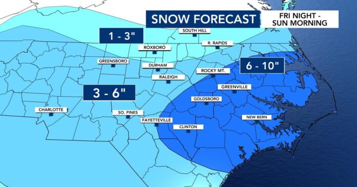
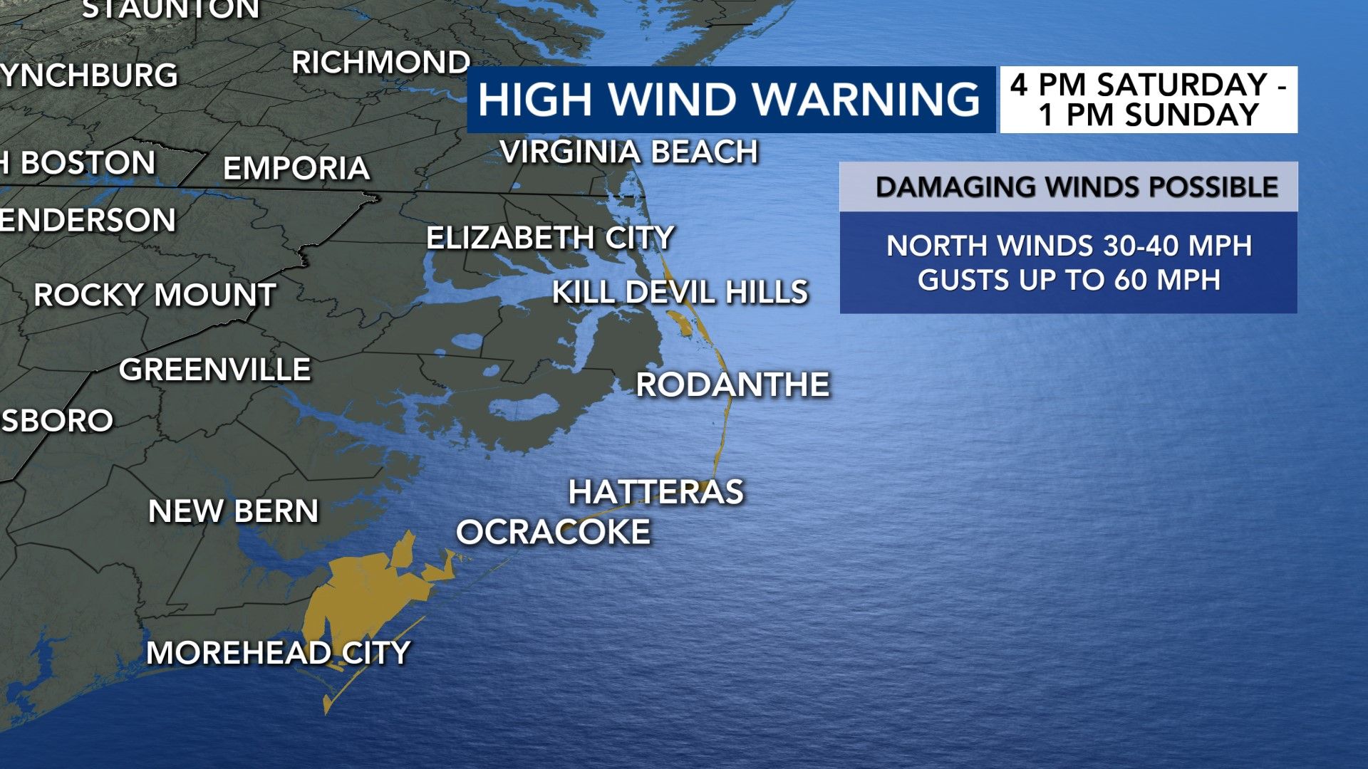
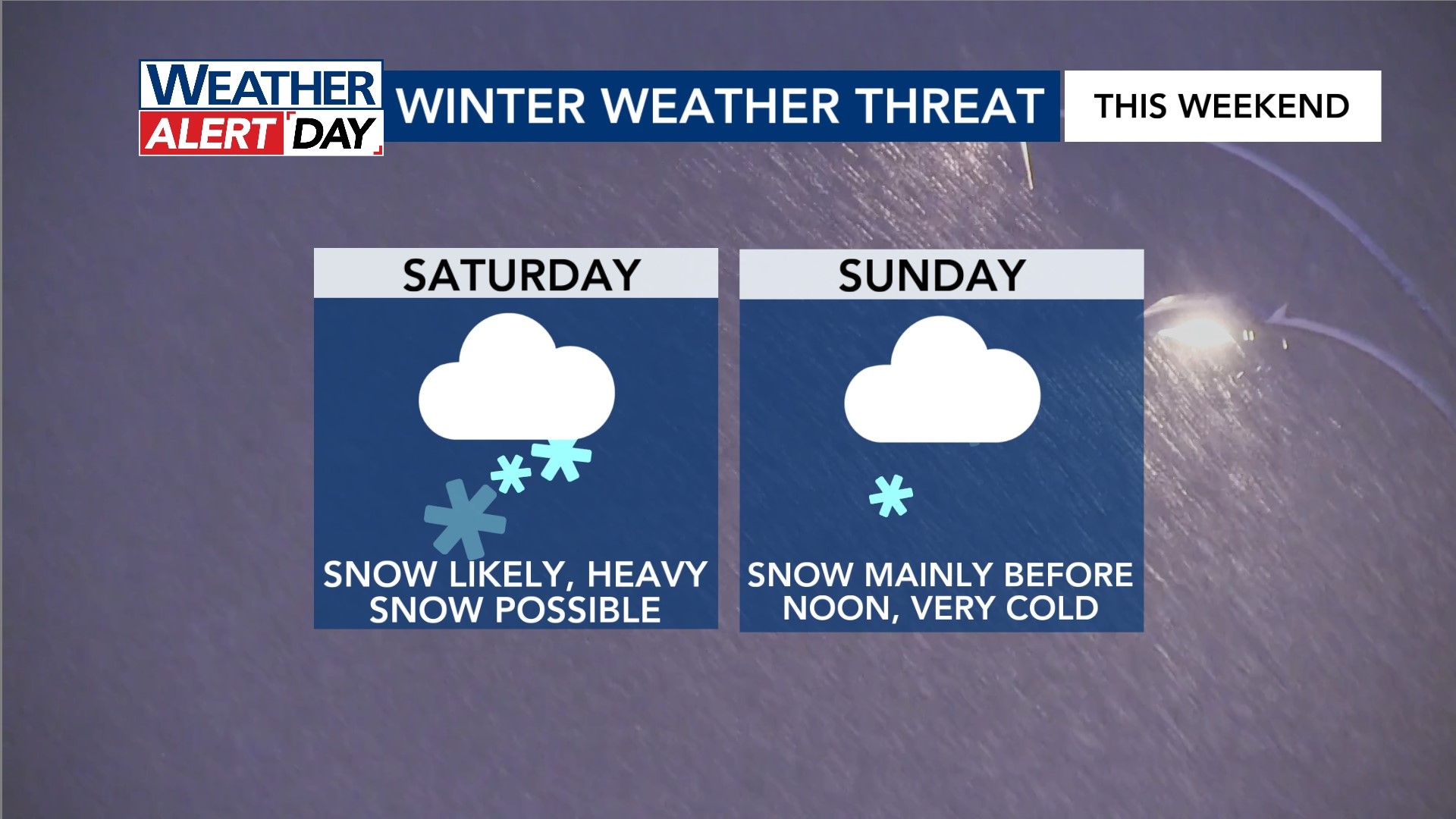
A winter storm warning goes is in effect for central North Carolina ahead of measurable snowfall in the state. The Triangle is expecting 3-6 inches of snow accumulation along with wind gusts of 30 to 40 mph.
Models indicate that snow will gradually spread from south to north late morning into the afternoon and evening Saturday. It will be a gradual process, though.
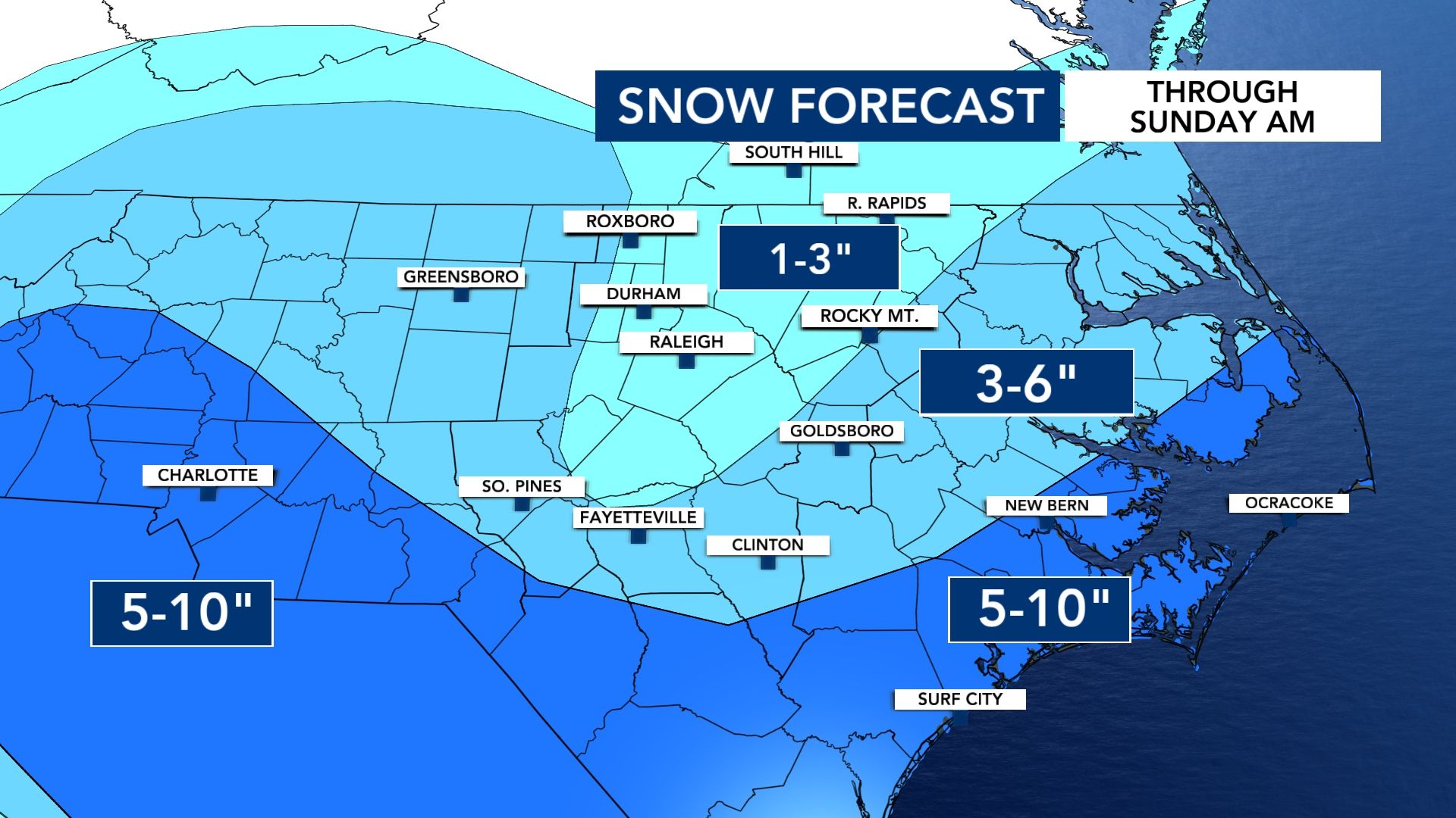
Early snow impacts on Friday
Schools and organizations across central N.C. are already canceling classes and events ahead of this weekend’s snowstorm that will move into the area late Friday night. There is no word yet on the status of classes and schools for Monday.
Local colleges and universities across the Triangle, including North Carolina Central University, UNC Chapel Hill and Duke University, have already begun preparing for the storm to come. Operations have been suspended through Sunday.
Both Durham and Wake County school systems have canceled weekend activities because of the weather.
Preparing for the weekend
Gov. Josh Stein declared a state of emergency, urging North Carolinians to prepare for accumulating snow, high winds, bitter cold and the possibility of power outages.
On Friday, Stein encouraged people to stay off the roads during the storm, which he warned could create “whiteout” conditions, making travel difficult.
Doug McNeil with the Department of Transportation said that crews already have shove operations in place that will start Friday night and will continue on a 24-hour basis. He also said that the NCDOT has already spread about 320,000 gallons of brines on the roads across central N.C. counties on Friday.
“The primary thing is to be able to restore traffic through the area and then into the communities on our main routes that allow emergency services, fire trucks, EMS, food deliveries to grocery stores to continue on,” McNeil said. “We focus on the main infrastructure first and then work into the rest of the network.”
Crews who have been brining and plowing the roads from last week’s storm have a quick turnaround to get back into preparing for this weekend’s storm conditions. Officials urge people that the best way to help out and support the hard-working crewmembers is to stay at home and let the trucks do their jobs.
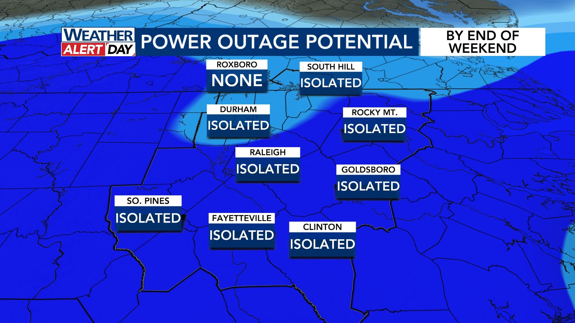
The forecast is also calling for gusts strong
enough to bring down limbs and trees alike. Duke Energy’s Jeff Brooks says
men and material are ready to go, ahead of this weekend’s snow storm. Crews
expect the winter weather to cause small to midsize outages all across the state.
“Not big clusters, you know, maybe a few 1000
people out in various places,” Brooks said.
Any wind stronger than 29 miles per hour means
Duke Energy crews won’t be able to get up in bucket trucks to make repairs –
potentially making any potential outages last longer.
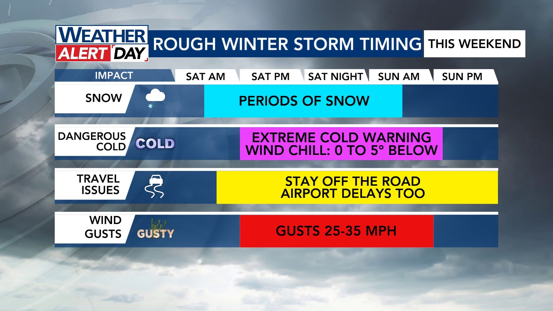
The winter storm warning, which began on Friday, continues through Sunday at 7 a.m. and impacts the entire state. Saturday and Sunday are WRAL Weather Alert Days due to our increasing snow chances.
Meteorologist Kat Campbell said shoveling should
be easier and may even help the plows on the roads as well.
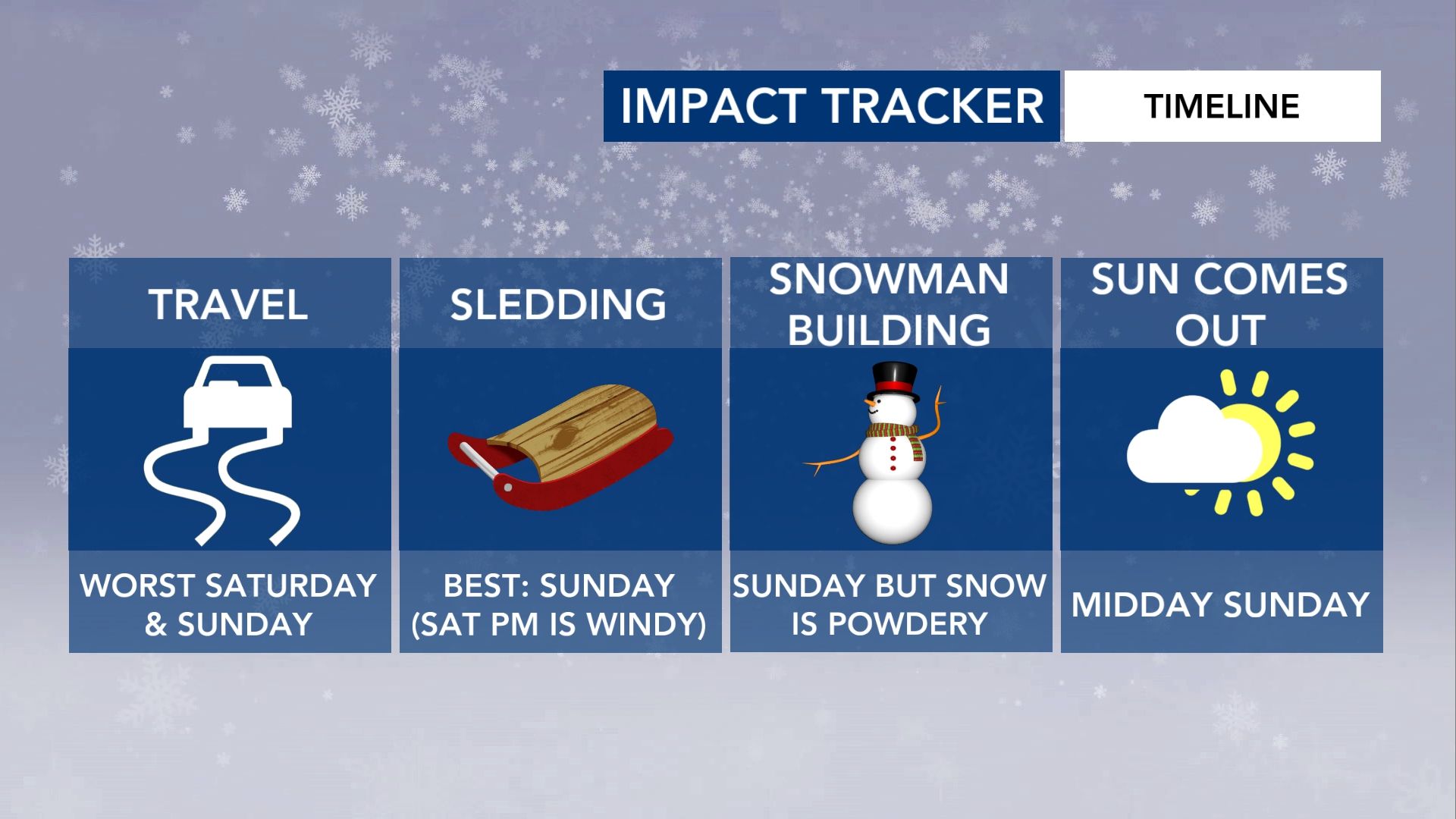
the sled this weekend. Campbell said the snow will be a little bit more powdery,
so building a snow man maybe a little harder.An upper-level low is still to our west, while surface low pressure is on the southeastern part of the
North Carolina coast.
Both will bring a lot of energy across the area
and allow for some pockets of heavy snow across the state.
So don’t worry if you wake up and don’t see snow
right away, meteorologist Aimee Wilmoth said it is just going to start a little
bit later.
“Extreme cold” to follow snow Sunday
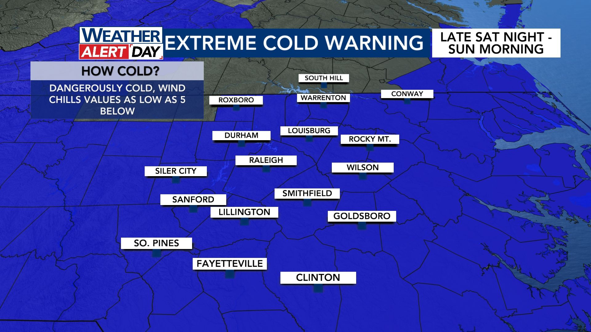
An Extreme Cold Warning is in effect for our area Sunday morning. Wind chills drop toward 0°, if not a few degrees below that.
Stay-tuned with us on our website


